
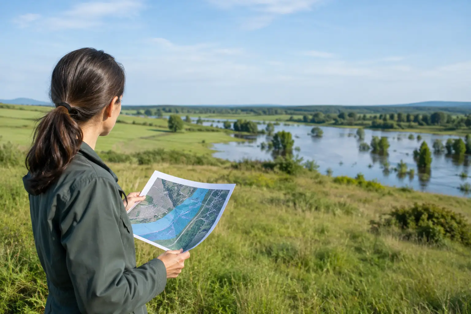
A low price can make an acreage listing look like the opportunity of a lifetime. But if the only buildable area floods, the driveway washes out, or insurance costs reshape your budget, that bargain can become expensive fast. Before making an offer, take time to evaluate flood risk as carefully as you would access, zoning, utilities, and title.
Flood exposure does not automatically make land a bad purchase. Plenty of valuable recreational, agricultural, waterfront, and rural parcels include flood-prone ground. The real question is whether the property’s flood conditions fit your intended use and your tolerance for added cost, restrictions, and uncertainty.
Start with the property’s intended use
Flood risk means different things for different buyers. A hunter may be perfectly comfortable with seasonal flooding on part of a timber tract. A buyer planning a primary residence, septic system, workshop, or RV site needs a much clearer path to safe construction and reliable access.
Be specific before you investigate. Ask whether you want to build a home, hold the parcel as an investment, run livestock, camp occasionally, farm it, or resell it. Then identify the features that must stay usable: the potential homesite, road frontage, driveway route, septic area, well location, electric connection, and any bridge or culvert crossing.
A 20-acre parcel may have only two acres outside a mapped floodplain, and those two acres may be steep, landlocked, or unsuitable for septic. On the other hand, 15 flood-prone acres may not matter much if the remaining five acres offer a legal, buildable homesite with all-weather access. Acreage alone does not answer the question.
Use flood maps as a first screen
Federal flood maps are one of the fastest ways to identify potential issues. Look up the parcel using the FEMA Flood Map Service Center, then compare the mapped flood zones to the parcel boundary shown on the county GIS map or survey. Do not assume a listing map is precise enough to settle the issue.
Areas labeled Special Flood Hazard Areas are generally associated with a one-percent annual chance of flooding, often called the 100-year floodplain. A mortgage lender may require flood insurance for a structure financed with a federally backed loan in these zones. Zones may also show floodways, coastal hazards, or areas where base flood elevations are established.
Treat the map as a starting point, not a final verdict. Some maps are old, parcel lines may not align perfectly on screen, and smaller drainage problems may not appear. A property outside a mapped high-risk zone can still flood during heavy rain, while a parcel inside a floodplain can still include usable upland ground.
Pay special attention to floodways
A floodway is usually more restrictive than the broader floodplain. It represents the channel and adjoining area needed to move floodwater without raising water levels too much. Building in or near a floodway can be limited, costly, or prohibited by local rules.
If a stream, river, or drainage channel crosses the land, ask the county floodplain administrator where the floodway lies and whether any proposed fill, driveway, bridge, or structure would need approval. Never assume you can solve the problem by bringing in dirt. Fill can trigger engineering requirements, permits, drainage impacts, and neighbor disputes.
Check local rules before you trust a buildable claim
County planning, zoning, building, environmental health, and floodplain offices can provide information that a national map cannot. Ask whether the parcel is subject to floodplain development rules, minimum finished-floor elevations, elevation certificates, compensatory storage requirements, or limits on manufactured homes and RVs.
If you plan to install septic, speak with the local health department or septic authority. High groundwater, poor drainage, and floodplain conditions can make a conventional septic system impossible or require a more expensive engineered design. A successful perc test from years ago is helpful, but it is not always enough for your specific building plan.
Also ask about permits for roads, culverts, creek crossings, wells, and utility extensions. The practical risk is often not water reaching a future house. It is losing access to the house after a storm because the only road crossing is undersized or poorly maintained.
Walk the land after rain if possible
Maps and records matter, but the ground tells its own story. If you can, visit after steady rain or during the wet season. Bring a printed parcel map, note the elevation changes, and inspect the route from the public road to the best potential building area.
Look for water-stained tree trunks, sediment deposits, flattened vegetation, exposed roots, washed-out ruts, standing water, drainage ditches, clogged culverts, and low spots with lush wetland plants. These clues do not replace a professional assessment, but they can reveal concerns that are easy to miss on a dry, sunny day.
Talk with neighboring owners, nearby farmers, and the local road department when appropriate. Ask direct questions: Does the road close during storms? How high does the creek get? Has water reached this field, driveway, or building site? Local experience is especially useful where official maps do not capture repeated flash flooding or drainage failures.
Verify elevation, not just the flood zone
For a homesite or other serious improvement, obtain better elevation information. A boundary survey confirms property lines, but it may not provide the detailed topography needed for flood decisions. Depending on the parcel and your plans, you may need a topographic survey, an elevation certificate, or input from a surveyor or civil engineer.
The key measurement is the relationship between the proposed building pad and the applicable base flood elevation. A parcel can sit partially in a flood zone while the planned structure location is safely above the required elevation. The reverse can also be true: land that looks high from the road may dip toward the only feasible building location.
This is where spending money before closing can protect a much larger investment. If the land is intended for a residence, commercial structure, or costly improvement, make your offer contingent on satisfactory due diligence whenever possible.
Price the full cost of flood exposure
Flood risk affects more than insurance. Factor in site design, engineered septic, raised foundations, drainage work, road improvements, culverts, bridge maintenance, permit fees, and the possibility of delayed construction. If financing is involved, ask your lender early whether flood insurance will be required and how that changes monthly carrying costs.
Insurance availability and pricing depend on the structure, location, elevation, coverage choices, and current program rules. Get real quotes for your likely building plan rather than relying on an estimate from a neighbor or seller. For vacant land with no structure, insurance may not be the immediate issue, but future buyers will evaluate the same risks when you sell.
A flood-prone parcel should be priced with its limitations in mind. That does not mean it has no value. Waterfront access, fertile bottomland, wildlife habitat, timber, and privacy can make it highly attractive to the right buyer. It does mean you should not compare it dollar-for-dollar with nearby land that has unrestricted, elevated building sites and paved access.
Make your offer protect your options
Before committing earnest money, review the deed restrictions, survey, access easements, seller disclosures, prior permits, and any available elevation or flood documentation. Confirm that the land has legal access that remains practical in wet conditions, not merely a line on a map.
For higher-stakes purchases, consider an inspection period that allows you to speak with county officials, obtain insurance quotes, inspect after rain, and consult a surveyor or engineer. This approach is not about finding a perfect parcel. It is about knowing what you are buying and negotiating from facts instead of hope.
BuyVacantLand.com makes it easier to compare land by location and intended use, but the strongest opportunities are still the ones that match your plans on the ground. A parcel with manageable flood exposure, a workable building area, and a price that reflects reality can be a smart purchase. Give yourself permission to walk away when the water, access, or permit questions do not add up – the right piece of land will give your plans room to grow.



Join The Discussion