A fence line can look official until you learn it is three feet off. A gravel drive can seem like part of a property until the county map says otherwise. If you want to know how to research parcel boundaries before buying or selling land, you need more than a quick glance at an online map. You need to compare records, understand what each source can and cannot tell you, and know when to bring in a surveyor.
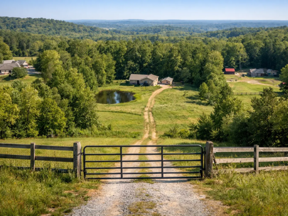
That matters even more with vacant land. There is usually no house, no obvious curb appeal, and no clear visual cue showing where one parcel ends and another begins. A buyer looking at acreage for recreation, homesteading, investment, or future development needs to verify the land on paper before making assumptions on the ground.
Why parcel boundary research matters
Boundary research protects you from simple but expensive mistakes. You might think a parcel has road frontage, creek access, extra acreage, or a better building site than it actually does. You might also assume a neighbor’s fence marks the line when it was placed for convenience, not accuracy.
For buyers, the payoff is confidence. You can judge whether the property fits your plans and whether the asking price makes sense. For sellers, cleaner boundary information can reduce buyer hesitation and speed up due diligence. It does not replace a formal survey, but it helps you spot red flags early.
How to research parcel boundaries step by step
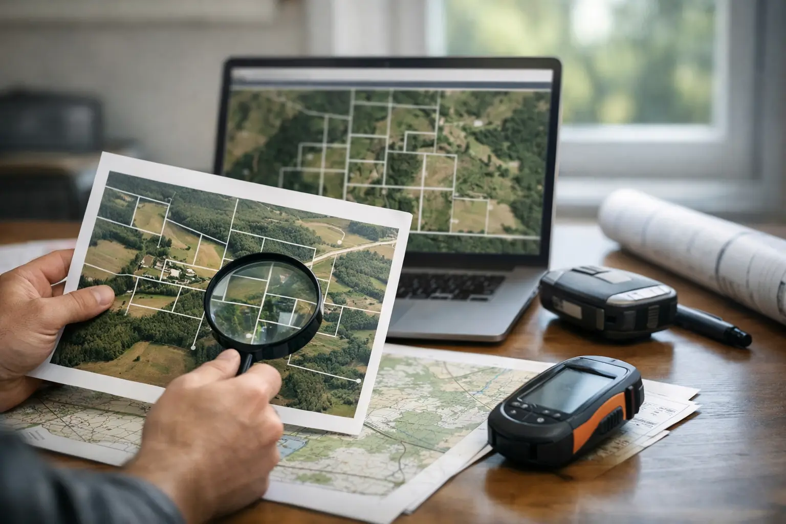
The smartest approach is to start with public records, then compare those records with mapping tools and what you see on site. No single source is perfect. The goal is to build a consistent picture.
Start with the parcel number and legal description
First, identify the parcel’s APN, tax parcel number, or assessor parcel number. You will usually find it in the listing, county tax records, or seller documents. That number is the key to most county-level information.
Then pull the legal description. This is not the same as a street address, and on vacant land there may not be a meaningful address at all. The legal description may reference a lot and block in a recorded subdivision, or it may use metes and bounds with distances, directions, monuments, and neighboring tracts.
The legal description is one of the most important pieces in parcel boundary research because it tells you how the land is defined in the public record. It can also tell you right away whether the parcel is simple and platted or more complex and rural.
Check the county assessor and GIS map
Most counties now offer online parcel maps through the assessor or GIS department. These maps are useful because they let you see parcel outlines, dimensions in some cases, neighboring tracts, road access, and sometimes topography, flood data, or zoning layers.
This is often the easiest place to begin if you are learning how to research parcel boundaries for the first time. You can quickly confirm whether the parcel shape matches the listing and whether the acreage appears consistent.
Still, county GIS maps come with limits. They are often labeled as approximate and not intended to establish legal boundary lines. In some counties, the linework is very good. In others, it is rough enough that a fence, road, or creek may appear to sit in the wrong place. Treat GIS as a strong reference point, not final proof.
Pull the deed and prior recorded documents
Next, look at the current deed and, if needed, earlier deeds in the chain of title. The county recorder or clerk’s office usually has these records online or in person. What you are looking for is consistency.
Does the deed’s legal description match the assessor record? Does it mention easements, exceptions, or rights-of-way? Has the parcel been split from a larger tract? If so, there may be older surveys, plats, or recorded boundary agreements that explain the current lines.
This part takes more patience than using a map, but it often reveals issues that the map does not show clearly. A shared driveway easement or utility easement may not change ownership of the land itself, but it can affect how you use it.
Look for a recorded plat or subdivision map
If the parcel is in a subdivision, a recorded plat can be one of the clearest sources available. Plats often show lot dimensions, bearings, block numbers, street dedications, and easements. They may also identify corner monuments that surveyors can use.
On a platted lot, boundary research can be more straightforward because the lines were formally laid out as part of the subdivision process. On unplatted rural acreage, the research may depend more heavily on deed language and surveys.
Compare online maps with aerial imagery
Aerial imagery can help you connect paper records to the land itself. When you compare parcel lines from county GIS with aerial views, you may notice tree lines, fences, cleared areas, roads, or neighboring uses that line up with the boundary – or do not.
That comparison is useful, but it can also be misleading. A tree line is not automatically a property line. The same goes for a gate, trail, or driveway. Aerials are best used as a clue, not a verdict.
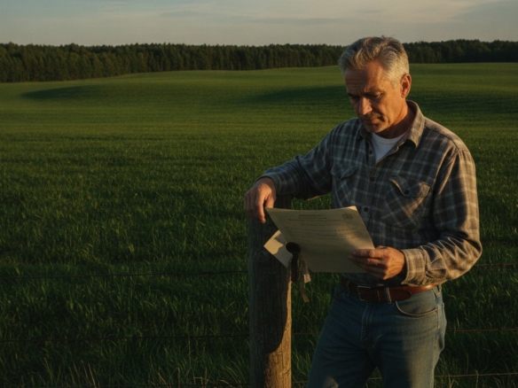
Visit the property and look for physical evidence
If possible, walk the parcel. Look for survey stakes, iron pins, capped rebar, marked trees, old fence corners, and any monuments mentioned in the legal description or plat. On some properties, especially in rural markets, these markers may be hard to find or buried under vegetation.
Bring a printed map or parcel overlay if you have one. A phone app can help with orientation, but GPS on consumer devices is not precise enough to confirm a legal boundary. It may get you close, not exact.
This is where trade-offs show up. A flat, rectangular lot in a subdivision may be easy to understand in person. A heavily wooded 40-acre tract with irregular metes and bounds can be much harder to interpret without professional help.
What county maps can tell you – and what they cannot
County parcel maps are excellent for screening properties. They help you verify parcel shape, approximate location, neighboring ownership patterns, and whether the land appears to have public road contact. For many buyers, that is enough to rule properties in or out before spending more money.
What they usually cannot do is settle a true boundary dispute. If the exact line matters because of access, building setbacks, fence placement, timber value, or a planned split, approximate mapping is not enough. That is where a survey becomes more than a nice extra.
When you need a land survey
If you are asking whether a survey is worth it, the real question is how much precision your deal requires. A survey is especially smart when the parcel is large, irregular, rural, recently divided, missing visible markers, or tied to any concern about access or encroachment.
A licensed land surveyor can locate or re-establish boundary corners, identify encroachments, map easements, and produce a survey that lenders, title companies, and future buyers may rely on. This is the strongest answer to how to research parcel boundaries when accuracy has financial consequences.
Not every deal needs a brand-new survey before you make an offer. Sometimes an existing recent survey is enough if it matches the current legal description and your title company is comfortable with it. But if the seller has no survey and the land presents any uncertainty, budgeting for one can save far more than it costs.
Common boundary issues buyers miss
The biggest mistake is assuming visible use equals legal ownership. That open field next to the parcel may belong to a neighbor. That road frontage may be separated by a public right-of-way or drainage strip. That pond may cross multiple parcels.
Another common issue is access. A parcel can look reachable on a map and still lack legal access if the route crosses private land without a recorded easement. Boundary research and access research are closely tied. You should evaluate both together.
There is also the issue of acreage claims. Listing descriptions sometimes round up, round down, or repeat old data. If the exact acreage affects value or your intended use, verify it through the deed, plat, survey, and county records instead of relying on marketing language.
A practical mindset for land buyers
The best land buyers stay curious, not casual. They know that boundary research is not about getting lost in paperwork. It is about making sure the property you think you are buying is the property you will actually own and use.
That mindset is especially useful when shopping across state lines or comparing rural parcels online. At BuyVacantLand.com, many buyers are looking for opportunity – affordable lots, recreational acreage, owner-financed land, or future homesites. The opportunity is real, but so is the need for careful due diligence.
If you take one thing with you, let it be this: start with the records, compare multiple sources, walk the land if you can, and know when to call a surveyor. Good boundary research does not slow a smart land deal down. It helps you move forward with a lot more confidence.

Join The Discussion